Proven methodology with short deployment cycle
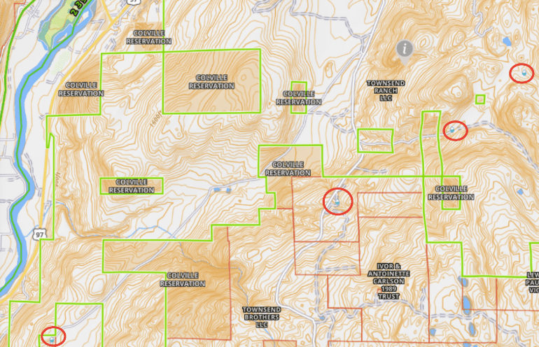
Primary Water Technologies LLC (USA) has developed a unique PrimaryWater™ methodology to pinpoint locate and precision drill for high quality groundwater worldwide. We start with the desktop collection of project data to include: topographical and geological maps; any water well borelogs and hydrochemical analyses on or near the project area; and all other client objectives and requirements. This is followed by lineament mapping and fracture trace analysis to determine faults, fissures and fracture zones in the project zone. These remote steps, usually requiring about two weeks, provide the exploration team with a set of data and maps to focus their surveys once on the ground. We then employ an easily deployed geophysical system for wide-area survey based on radiometric gamma ray scintillation counting that permits us to ground-truth the desktop studies while driving in a vehicle or ATV, on foot and even by drone. We then narrow down to prospective areas for passive seismic surveys that provide rapid 2D and 3D acoustic profiles of the lithology below to reveal formations and structures highly prospective for groundwater. During the exploration phase, we counsel the client regarding optimal drilling rigs--preferably a dual rotary (DR) like the Foremost, or a standard rotary air hammer with powerful compressor capable of 100% air drilling. Given reasonable local conditions, most boreholes can be completed in a day or two!
Map study
For a given site, we compile information to describe its hydrological potential.
Processing available data to describe the hydro-geological potential of a site
We source high-technological data and interpret it in order to set up the best strategy to locate water on-site.
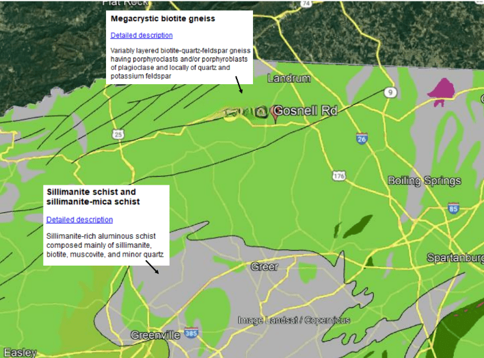
Geological maps
Identify the rock types
Geological maps show what rocks form the underground. Our interpretation is for how primary water moves through different rocks and for the possibility to drill.
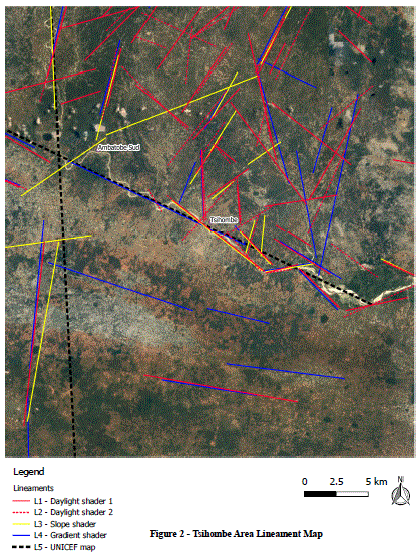
Lineament study and fracture trace analysis
Underground channels
Underground water moves through the rocks within fissures and faults. Lineament study and fracture trace analysis allows us to predict where those natural water conducts are most likely to be found.
Water points
Where is underground water already located
Well records give valuable information about underground water in a specific area.
Geophysical data
Gravitational, magnetic and aeroradiometric anomalies
This data gives information about the probability to find deep, mid and shallow aquifers.
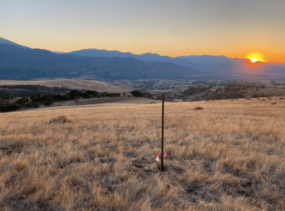
On-site survey
Our proven methodology and high technological instruments enable us to pinpoint locate underground water.
Precision locating underground water in 3D
We show where on the surface and how deep you need to drill to reach primary water.
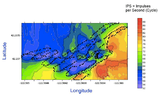
Radiometrics
Measuring the gamma radiation
We walk, drive or fly over the site, measuring the value of the natural gamma radiation, with a gamma scintillation counter.
Identifying zones of interest
Interpreting the gamma map
The trends in gamma values dictate where we collect our passive seismic data.
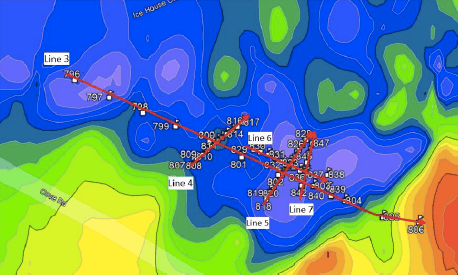
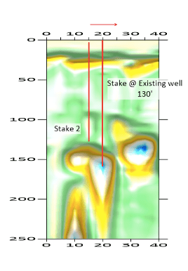
Passive seismic
Resonance Acoustic Profiling
We survey the selected areas down to hundreds - even thousands - of feet to map the underground structures.
Interpreting the data
Precision-locating the water
We overlay both data sets, gamma and RAP, to 3D-locate the water and mark the best location for a sustainable well.
Case studies
Chekshani Cliffs project
Watch this video that describes our methodology.
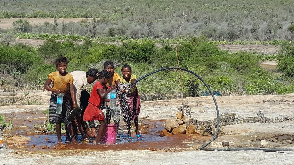
Madagascar Consortium
A team of scientists located abundant and potable water with gamma scintillation counter technology in an arid area.